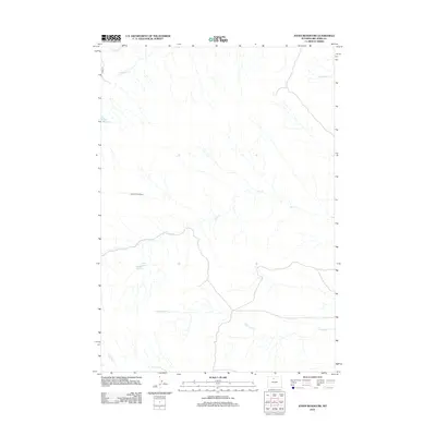
2012 Map of Jones Reservoir
USGS Topo · Published 2012About this map
Jones Reservoir and the adjacent Snoopy Reservoir anchor this arid stretch of Big Horn County, where water management is central to the landscape. The intricate network of drainage includes Elk Cr and its S Fork Elk Cr, alongside smaller flows like Dorsey Cr and Antelope Cr. A distinctive point of interest is the Snort Geyser, located near the southern reservoir, suggesting geothermal activity beneath the surface. Human intervention in this high-plains environment is marked by agricultural and boundary infrastructure, notably the Sandstone Ditch in the northwest and the extensive Dorsey Creek Fence. Apart from Co RD 17, the area remains largely defined by its natural watercourses and the seasonal drainage of Fivemile Cr, reflecting a region dedicated to ranching and resource management.
Find a feature on this map
11 named features on this map. Tap any name to fly to it.
Don’t see what you’re looking for? This feature index may not catch every label — zoom into the map to look around manually.
Map Details
Editions of this 2012 Jones Reservoir Map
This is the sole edition of this map. No revisions or reprints were ever made.
Other maps of this area

1951 · Sucker Dam
USGS Topo · 1:24,000

1951 · Schuster Flats NE
USGS Topo · 1:24,000

1951 · Schuster Flats NW
USGS Topo · 1:24,000

1951 · Wardel Reservoir
USGS Topo · 1:24,000

1951 · Otto
USGS Topo · 1:24,000

1955 · Cody
USGS Topo · 1:250,000

1958 · Cody
USGS Topo · 1:250,000

1962 · Cody
USGS Topo · 1:250,000
1966 · Gould Butte
USGS Topo · 1:24,000
1966 · Orchard Bench
USGS Topo · 1:24,000