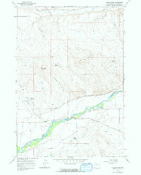
1966 Map of Gould Butte
USGS Topo · Published 1969About this map
The Greybull River meanders across this mid-1960s landscape, serving as the vital lifeline for a sophisticated network of irrigation systems including the Farmers Canal, Gould Canal, and the Agrarian Ditch. This reliance on water management is further evidenced by several small impoundments such as Hump Reservoir and Mc Kinnie Reservoir, which support the agricultural activity surrounding Emblem Bench. The map captures the infrastructure of the era, from the Pipeline in the northeast to the Gaging Sta along the riverbank.
Find a feature on this map
28 named features on this map. Tap any name to fly to it.
Don’t see what you’re looking for? This feature index may not catch every label — zoom into the map to look around manually.
Map Details
Editions of this 1966 Gould Butte Map
2 editions found
Other maps of this area

1951 · Wardel Reservoir
USGS Topo · 1:24,000

1951 · Otto
USGS Topo · 1:24,000

1955 · Cody
USGS Topo · 1:250,000

1958 · Cody
USGS Topo · 1:250,000

1962 · Cody
USGS Topo · 1:250,000
1966 · Sheep Canyon
USGS Topo · 1:24,000
1966 · Orchard Bench
USGS Topo · 1:24,000
1966 · Greybull South
USGS Topo · 1:24,000
1966 · Greybull North
USGS Topo · 1:24,000

1966 · Emblem SE
USGS Topo · 1:24,000