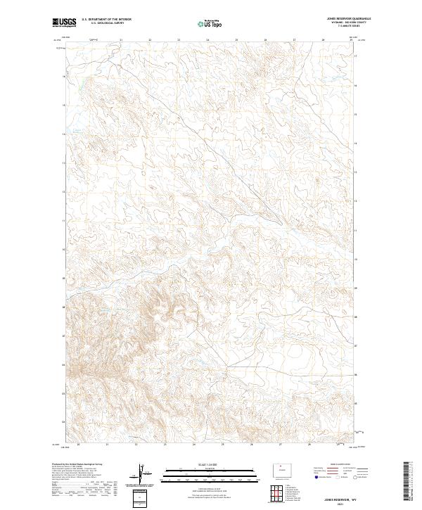
2021 Map of Jones Reservoir
USGS Topo · Published 2021About this map
Jones Reservoir serves as a primary water source in this high-plains landscape of Big Horn County, where the terrain is defined by a network of drainage systems feeding into larger basins. This modern topographic study reveals a landscape shaped by intermittent water flow, including the distinct channels of Dorsey Cr and Elk Cr. One of the more unique hydrological features present is Short Geyser, located southeast of the main reservoir, indicating geothermal activity in this corner of the state. The infrastructure remains sparse, characterized primarily by Co RD 17 and a few secondary access routes that follow the contours of the land. These survey details provide a clear view of the hydraulic engineering and natural drainage patterns, from the S Fork Elk Cr to the eastern reaches of Antelope Cr, within the established township and range boundaries.
Find a feature on this map
13 named features on this map. Tap any name to fly to it.
Don’t see what you’re looking for? This feature index may not catch every label — zoom into the map to look around manually.
Map Details
Editions of this 2021 Jones Reservoir Map
This is the sole edition of this map. No revisions or reprints were ever made.
Other maps of this area

1951 · Sucker Dam
USGS Topo · 1:24,000

1951 · Schuster Flats NE
USGS Topo · 1:24,000

1951 · Schuster Flats NW
USGS Topo · 1:24,000

1951 · Wardel Reservoir
USGS Topo · 1:24,000

1951 · Otto
USGS Topo · 1:24,000

1955 · Cody
USGS Topo · 1:250,000

1958 · Cody
USGS Topo · 1:250,000

1962 · Cody
USGS Topo · 1:250,000
1966 · Gould Butte
USGS Topo · 1:24,000
1966 · Orchard Bench
USGS Topo · 1:24,000