
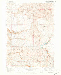
1969 Map of Jordan Craters South
USGS Topo · Published 1973About this map
Jordan Craters dominates this corner of Malheur County, Oregon, where expansive Lava fields define the geologic character of the high desert. The 1968 aerial survey reveals a landscape where human utility is focused on water management for livestock or industry, evidenced by the scattered development of Crater Lake Well, Lava Well, and several isolated reservoirs. Volcanic formations like Clarks Butte, Biscuit Butte, and Saddle Butte rise above the basaltic plains, serving as primary navigation landmarks.
Find a feature on this map
15 named features on this map. Tap any name to fly to it.
Don’t see what you’re looking for? This feature index may not catch every label — zoom into the map to look around manually.
Map Details
Editions of this 1969 Jordan Craters South Map
This is the sole edition of this map. No revisions or reprints were ever made.
Other maps of this area

1955 · Jordan Valley
USGS Topo · 1:250,000

1955 · Boise
USGS Topo · 1:250,000

1957 · Jordan Valley
USGS Topo · 1:250,000

1958 · Boise
USGS Topo · 1:250,000

1958 · Jordan Valley
USGS Topo · 1:250,000

1962 · Boise
USGS Topo · 1:250,000

1969 · Mc Cain Creek
USGS Topo · 1:24,000

1969 · Jordan Craters North
USGS Topo · 1:24,000

1969 · Cow Lakes
USGS Topo · 1:24,000
1969 · Threemile Hill
USGS Topo · 1:24,000