
1969 Map of Jordan Craters North
USGS Topo · Published 1973About this map
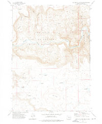
The volcanic landscape of southeastern Oregon is sharply defined here by the expansive fields of Lava that comprise the Jordan Craters. This late-1960s survey illustrates a rugged terrain where modern geology meets high-desert water management, centered on the prominent Coffeepot Crater. The western edge of the map is dominated by the deeply carved path of the Owyhee River, which features a Gaging Station and evidence of early livestock infrastructure near Birch Springs. A network of catchment points across the arid uplands, including Blue Canyon Reservoir, Glover Reservoir, and Blowout Reservoir, suggests the area's importance for cattle ranching. The presence of numerous Jeep Trails winding through features like The Tongue and along Birch Creek provides a clear view of the routes used to navigate this geologically active corner of Malheur County.
Find a feature on this map
22 named features on this map. Tap any name to fly to it.
Don’t see what you’re looking for? This feature index may not catch every label — zoom into the map to look around manually.
Map Details
Editions of this 1969 Jordan Craters North Map
This is the sole edition of this map. No revisions or reprints were ever made.
Other maps of this area

1955 · Boise
USGS Topo · 1:250,000

1958 · Boise
USGS Topo · 1:250,000

1962 · Boise
USGS Topo · 1:250,000

1967 · Diamond Butte
USGS Topo · 1:24,000

1967 · Rooster Comb
USGS Topo · 1:24,000

1969 · Jordan Craters South
USGS Topo · 1:24,000

1969 · Mc Cain Creek
USGS Topo · 1:24,000

1969 · Cow Lakes
USGS Topo · 1:24,000

1972 · Big Mud Flat
USGS Topo · 1:24,000
1972 · The Hole In The Ground
USGS Topo · 1:24,000