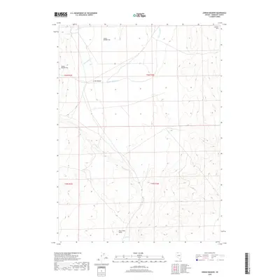
2018 Map of Jordan Meadow
USGS Topo · Published 2018About this map
Jordan Meadow defines this high-elevation corner of Humboldt County, where water sources like Indian Spring and the drainage of Crowley Cr were historically vital for land use. The topography is dominated by the massive Jordan Meadow Mtn and the broad expanse of Jordan Meadow Flat, illustrating the transition from steep peaks to the flat floors of Trout Creek Valley. This 2018 survey documents a landscape largely unchanged in its fundamental geographic markers, preserving the original nomenclature of seasonal waterways including Wildcat Cr, Little Wildcat Cr, and Jordan Meadow Cr. The survey detail captures the sparse but critical network of springs and hills, such as the Sentinel Hills, that have guided travelers through this interior basin-and-range territory for generations.
Find a feature on this map
14 named features on this map. Tap any name to fly to it.
Don’t see what you’re looking for? This feature index may not catch every label — zoom into the map to look around manually.
Map Details
Editions of this 2018 Jordan Meadow Map
This is the sole edition of this map. No revisions or reprints were ever made.
Other maps of this area

1882 · Paradise
USGS Topo · 1:250,000

1886 · Disaster
USGS Topo · 1:250,000

1893 · Paradise
USGS Topo · 1:250,000

1893 · Disaster
USGS Topo · 1:250,000

1954 · Vya
USGS Topo · 1:250,000

1955 · McDermitt
USGS Topo · 1:250,000

1958 · Vya
USGS Topo · 1:250,000

1959 · McDermitt
USGS Topo · 1:250,000

1959 · Orovada
USGS Topo · 1:62,500

1959 · Jordan Meadow
USGS Topo · 1:62,500