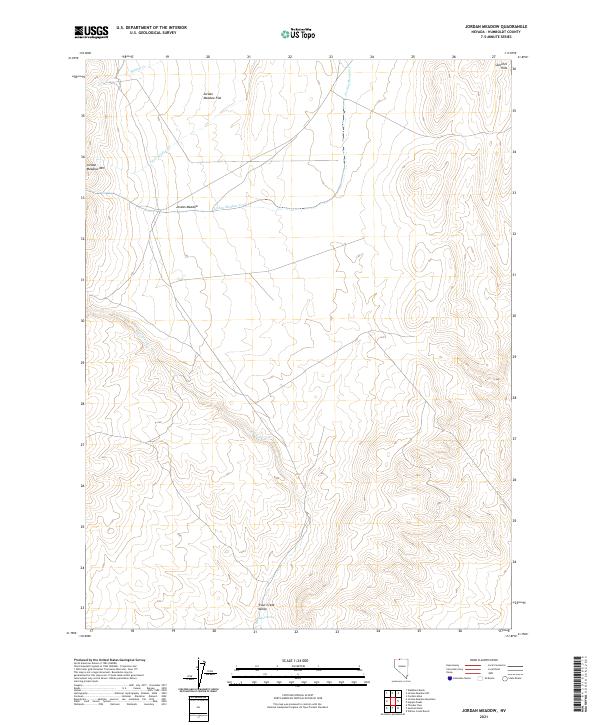
2021 Map of Jordan Meadow
USGS Topo · Published 2021About this map
Jordan Meadow defines the heart of this high-desert basin, where drainage patterns from the surrounding peaks converge into a complex system of seasonal creeks. The landscape is structured by the prominent Jordan Meadow Mtn to the west and the Sentinel Hills in the northeast, creating a natural corridor that has historically supported livestock and grazing. Water sources are critical in this arid environment, evidenced by the presence of Indian Spring and the meandering path of Crowley Cr through the Trout Creek Valley. This area reflects the remote ranching and grazing geography of northern Nevada, where named features often revolve around the few reliable meadows and springs like Jordan Meadow Flat that provide respite from the sagebrush-covered hills.
Find a feature on this map
14 named features on this map. Tap any name to fly to it.
Don’t see what you’re looking for? This feature index may not catch every label — zoom into the map to look around manually.
Map Details
Editions of this 2021 Jordan Meadow Map
This is the sole edition of this map. No revisions or reprints were ever made.
Other maps of this area

1882 · Paradise
USGS Topo · 1:250,000

1886 · Disaster
USGS Topo · 1:250,000

1893 · Paradise
USGS Topo · 1:250,000

1893 · Disaster
USGS Topo · 1:250,000

1954 · Vya
USGS Topo · 1:250,000

1955 · McDermitt
USGS Topo · 1:250,000

1958 · Vya
USGS Topo · 1:250,000

1959 · McDermitt
USGS Topo · 1:250,000

1959 · Orovada
USGS Topo · 1:62,500

1959 · Jordan Meadow
USGS Topo · 1:62,500