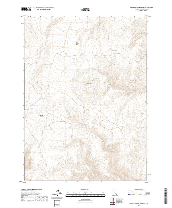
2021 Map of Jordan Meadow Mountain
USGS Topo · Published 2021About this map
Jordan Meadow Mtn dominates the northeastern corner of this Humboldt County landscape, serving as a prominent landmark in a terrain defined by complex drainages and high basins. The topography centers on the Seven Springs Basin, where the headwaters of numerous seasonal streams originate before cutting through the surrounding heights. This 2021 survey illustrates a remote section of the Montana Mountains, where water sources are vital geographic markers. Water features such as Lone Willow Spring, Lyles Spring, and Big Bend Spring indicate the critical role of these localized seeps in the Great Basin environment. The drainage pattern is particularly evident along the paths of Washburn Cr and Crowley Cr, which channel runoff through the high desert reaches. This map is an essential reference for understanding the hydrological connectivity of the northwestern Nevada backcountry.
Find a feature on this map
18 named features on this map. Tap any name to fly to it.
Don’t see what you’re looking for? This feature index may not catch every label — zoom into the map to look around manually.
Map Details
Editions of this 2021 Jordan Meadow Mountain Map
This is the sole edition of this map. No revisions or reprints were ever made.
Other maps of this area

1882 · Paradise
USGS Topo · 1:250,000

1886 · Disaster
USGS Topo · 1:250,000

1893 · Paradise
USGS Topo · 1:250,000

1893 · Disaster
USGS Topo · 1:250,000

1954 · Vya
USGS Topo · 1:250,000

1955 · McDermitt
USGS Topo · 1:250,000

1958 · Vya
USGS Topo · 1:250,000

1959 · McDermitt
USGS Topo · 1:250,000

1959 · Orovada
USGS Topo · 1:62,500

1959 · Jordan Meadow
USGS Topo · 1:62,500