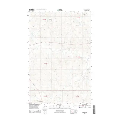
2014 Map of Jordan SE
USGS Topo · Published 2014About this map
Big Dry Creek and its many tributaries carve a network of drainage channels across this portion of Garfield County, defining a landscape dominated by the semi-arid plains of eastern Montana. The map illustrates a region structured by the Public Land Survey System, with the intersection of several townships including t18n r39e and t17n r38e. While the terrain is largely rural and characterized by wide coulees such as Oliver Coulee and Russian Coulee, human infrastructure is present in the form of state routes like MT-200 and MT-59. A notable crossing point occurs at the Sand Creek Bridge in the southwestern quadrant, where the road meets the winding path of Sand Creek. The density of named waterways, from Vail Cr to Jones Cr, highlights the vital importance of drainage and seasonal water flow in this ranching country.
Find a feature on this map
22 named features on this map. Tap any name to fly to it.
Don’t see what you’re looking for? This feature index may not catch every label — zoom into the map to look around manually.
Map Details
Editions of this 2014 Jordan SE Map
This is the sole edition of this map. No revisions or reprints were ever made.
Other maps of this area

1954 · Jordan
USGS Topo · 1:250,000

1956 · Jordan
USGS Topo · 1:250,000

1958 · Jordan
USGS Topo · 1:250,000

1964 · Jordan
USGS Topo · 1:250,000

1964 · Jordan SE
USGS Topo · 1:24,000

1964 · Jordan NE
USGS Topo · 1:24,000

1964 · Bateman Coulee
USGS Topo · 1:24,000

1964 · Black John Coulee
USGS Topo · 1:24,000

1964 · Jordan NW
USGS Topo · 1:24,000

1964 · Jordan
USGS Topo · 1:24,000