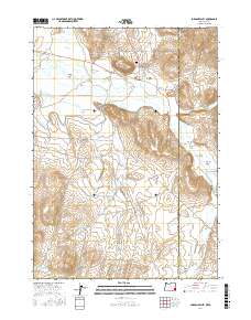
2017 Map of Jordan Valley
USGS Topo · Published 2017About this map
Jordan Valley serves as the primary hub in this borderland landscape where southeastern Oregon meets the Idaho line. The town's grid is defined by streets like Yturri Blvd and Main St, with the Jordan Valley Cem situated just north near Pharmacy Hill. The surrounding high desert terrain is heavily modified for water management, featuring the extensive Antelope Feeder Canal which cuts across the western slopes to direct flow toward agricultural uses.
Find a feature on this map
44 named features on this map. Tap any name to fly to it.
Don’t see what you’re looking for? This feature index may not catch every label — zoom into the map to look around manually.
Map Details
Editions of this 2017 Jordan Valley Map
This is the sole edition of this map. No revisions or reprints were ever made.
Other maps of this area

1892 · Silver City
USGS Topo · 1:125,000

1894 · Silver City
USGS Topo · 1:125,000

1898 · Silver City
USGS Topo · 1:125,000

1955 · Jordan Valley
USGS Topo · 1:250,000

1955 · Boise
USGS Topo · 1:250,000

1957 · Jordan Valley
USGS Topo · 1:250,000

1958 · Boise
USGS Topo · 1:250,000

1958 · Jordan Valley
USGS Topo · 1:250,000

1962 · Boise
USGS Topo · 1:250,000

1965 · Rooster Comb Peak
USGS Topo · 1:62,500