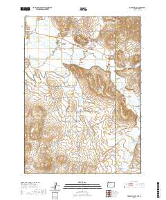
2020 Map of Jordan Valley
USGS Topo · Published 2020About this map
Jordan Valley sits along the Jordan Cr in this high-desert region of Malheur County, Oregon, where the landscape is defined by irrigation engineering and seasonal watercourses. The town center is marked by its Po and the prominent Pharmacy Hill rising just north of Main St. Local history and genealogy interests are centered on the Jordan Valley Cem, located near the intersection of Somerville St and Pharmacy Hill Rd.
Find a feature on this map
45 named features on this map. Tap any name to fly to it.
Don’t see what you’re looking for? This feature index may not catch every label — zoom into the map to look around manually.
Map Details
Editions of this 2020 Jordan Valley Map
This is the sole edition of this map. No revisions or reprints were ever made.
Other maps of this area

1892 · Silver City
USGS Topo · 1:125,000

1894 · Silver City
USGS Topo · 1:125,000

1898 · Silver City
USGS Topo · 1:125,000

1955 · Jordan Valley
USGS Topo · 1:250,000

1955 · Boise
USGS Topo · 1:250,000

1957 · Jordan Valley
USGS Topo · 1:250,000

1958 · Boise
USGS Topo · 1:250,000

1958 · Jordan Valley
USGS Topo · 1:250,000

1962 · Boise
USGS Topo · 1:250,000

1965 · Rooster Comb Peak
USGS Topo · 1:62,500