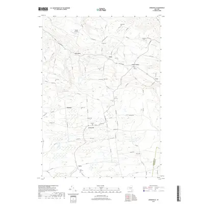
2019 Map of Jordanville
USGS Topo · Published 2019About this map
The town of Jordanville serves as a central hub in this Herkimer County landscape, where small hamlets like Kingdom, Edicks, and Paines Hollow are connected by a network of winding roads including Rd 2 Mohawk and Jordanville Rd. The area is characterized by a high concentration of family and community burial grounds, such as Jordanville Cem, Paine-Swift Cem, and Crain Memorial Cem, which offer significant value for genealogical research. The terrain is defined by prominent elevations like Harter Hill and Murray Hill, while water bodies such as Mud Lake and Fulmer Cr provide drainage for the surrounding valleys. Aviation history is noted by the presence of the Mohawk Aviation Center LLC and the Sky-Ranch Airport in the northern reaches of the quadrangle. This 2019 survey documents the enduring rural character of the region as it transitions across the Herkimer Co and Otsego Co line.
Find a feature on this map
90 named features on this map. Tap any name to fly to it.
Don’t see what you’re looking for? This feature index may not catch every label — zoom into the map to look around manually.
Map Details
Editions of this 2019 Jordanville Map
This is the sole edition of this map. No revisions or reprints were ever made.
Other maps of this area

1898 · Utica
USGS Topo · 1:62,500

1900 · Little Falls
USGS Topo · 1:62,500

1900 · Utica
USGS Topo · 1:62,500

1903 · Richfield Springs
USGS Topo · 1:62,500

1903 · Little Falls
USGS Topo · 1:62,500

1907 · Winfield
USGS Topo · 1:62,500

1939 · Little Falls
USGS Topo · 1:62,500

1943 · Schuyler Lake
USGS Topo · 1:24,000

1943 · Jordanville
USGS Topo · 1:24,000

1943 · Richfield Springs
USGS Topo · 1:24,000