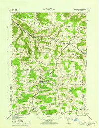
1945 Map of Jordanville
USGS Topo · Published 1945About this map
Holy Trinity Monastery sits as a prominent landmark in this mid-1940s landscape, positioned just north of the village of Jordanville. This region of New York is defined by a series of high ridges and hills, including Shoemaker Hill and Rock Hill, which separate the drainage of Fulmer Creek from the southern lowlands around Mud Lake. The map reveals a dense network of local schools and family-named cemeteries that speak to the established rural communities of German Flatts, Warren, and Columbia. Researchers will find significant genealogical detail in the numerous burial grounds such as Paine Cem, Piper Cem, and Heath Cem, which are scattered along the winding upland roads like Oregon Road and Johnnycake Street Road. Small hamlets like Edicks, Paines Hollow, and Crains Corners serve as anchor points across this agricultural and monastic terrain.
Find a feature on this map
41 named features on this map. Tap any name to fly to it.
Don’t see what you’re looking for? This feature index may not catch every label — zoom into the map to look around manually.
Map Details
Editions of this 1945 Jordanville Map
This is the sole edition of this map. No revisions or reprints were ever made.
Other maps of this area

1898 · Utica
USGS Topo · 1:62,500

1900 · Little Falls
USGS Topo · 1:62,500

1900 · Utica
USGS Topo · 1:62,500

1903 · Richfield Springs
USGS Topo · 1:62,500

1903 · Little Falls
USGS Topo · 1:62,500

1907 · Winfield
USGS Topo · 1:62,500

1939 · Little Falls
USGS Topo · 1:62,500

1943 · Schuyler Lake
USGS Topo · 1:24,000

1943 · Jordanville
USGS Topo · 1:24,000

1943 · Richfield Springs
USGS Topo · 1:24,000