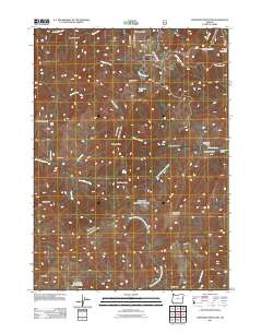
2011 Map of Josephine Mountain
USGS Topo · Published 2011About this map
Josephine Mountain and the surrounding Kalmiopsis Wilderness heights define this 2011 survey of Josephine County. The landscape is marked by the resource extraction history of Southern Oregon, evidenced by the high-elevation Babyfoot Mine and the Alberg Mine located near Josephine Creek. These sites reflect the region's enduring connection to mining, even as much of the area transitioned toward conservation and recreation.
Find a feature on this map
37 named features on this map. Tap any name to fly to it.
Don’t see what you’re looking for? This feature index may not catch every label — zoom into the map to look around manually.
Map Details
Editions of this 2011 Josephine Mountain Map
This is the sole edition of this map. No revisions or reprints were ever made.
Other maps of this area

1917 · Kerby
USGS Topo · 1:125,000

1918 · Kerby
USGS Topo · 1:125,000

1945 · Kerby
USGS Topo · 1:125,000

1954 · Cave Junction
USGS Topo · 1:62,500

1954 · Selma
USGS Topo · 1:62,500

1954 · Chetco Peak
USGS Topo · 1:62,500

1954 · Pearsoll Peak
USGS Topo · 1:62,500

1955 · Medford
USGS Topo · 1:250,000

1957 · Medford
USGS Topo · 1:250,000

1958 · Medford
USGS Topo · 1:250,000