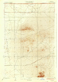
1934 Map of Joshua
USGS Topo · Published 1934About this map
The arid floor of the Antelope Valley dominates this 1930s survey, showing a landscape defined by expansive desert basins and isolated geological formations. In the northern reaches, Rogers Dry Lake provides a level, alkaline expanse, while the southern terrain is punctuated by a prominent Butte. The early grid of desert infrastructure is visible through the positioning of Avenue B and Avenue H, providing a framework for the sparse settlement and agricultural efforts of the era. A handful of scattered wells are the primary indicators of human activity, marking the critical points where water was sought to sustain life in this high desert environment near the boundary of Kern and Los Angeles Counties.
Find a feature on this map
9 named features on this map. Tap any name to fly to it.
Don’t see what you’re looking for? This feature index may not catch every label — zoom into the map to look around manually.
Map Details
Editions of this 1934 Joshua Map
3 editions found
Other maps of this area

1930 · Joshua
USGS Topo · 1:24,000

1930 · Lovejoy Springs
USGS Topo · 1:24,000

1930 · Casa Desierta
USGS Topo · 1:24,000

1930 · West Alpine Butte
USGS Topo · 1:24,000

1930 · Wilsona
USGS Topo · 1:24,000

1931 · Hi Vista
USGS Topo · 1:24,000

1933 · Casa Desierta
USGS Topo · 1:24,000

1933 · Lovejoy Springs
USGS Topo · 1:24,000
1933 · West Alpine Butte
USGS Topo · 1:24,000

1934 · Joshua
USGS Topo · 1:24,000