1934 Map of Joshua
USGS Topo · Published 1934About this map
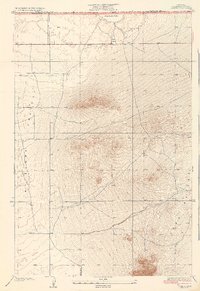
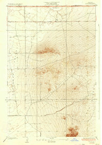
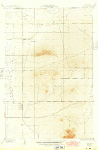
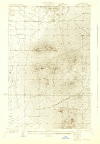
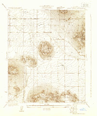
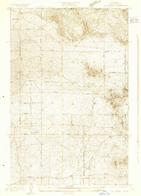
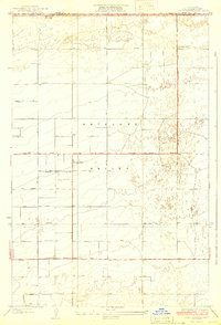
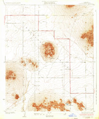
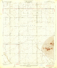
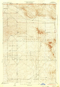
Antelope Valley dominates this 1930s landscape, where the arid floor of the Mojave Desert meets a cluster of prominent Buttes in northeastern Los Angeles County. The terrain is defined by extreme relief, transitioning from the flat expanse of the valley floor to the sharp elevations of the rocky outcrops. To the north, the southern edge of Rogers Dry Lake is visible, a feature that would later become central to the region's aerospace history. Scattered across this sparse landscape are several isolated wells, indicating the critical search for water in this high-desert environment. The survey also captures early infrastructure, including the straight, grid-aligned tracks of Avenue and 150 Th St E, which provide the skeletal framework for future development in this corner of the county.
Find a feature on this map
8 named features on this map. Tap any name to fly to it.
Don’t see what you’re looking for? This feature index may not catch every label — zoom into the map to look around manually.
Map Details
Editions of this 1934 Joshua Map
3 editions found
Other maps of this area
1930 · Joshua
USGS Topo · 1:24,000
1930 · Lovejoy Springs
USGS Topo · 1:24,000
1930 · Casa Desierta
USGS Topo · 1:24,000
1930 · West Alpine Butte
USGS Topo · 1:24,000
1930 · Wilsona
USGS Topo · 1:24,000
1931 · Hi Vista
USGS Topo · 1:24,000
1933 · Casa Desierta
USGS Topo · 1:24,000
1933 · Lovejoy Springs
USGS Topo · 1:24,000
1933 · West Alpine Butte
USGS Topo · 1:24,000
1935 · Hi Vista
USGS Topo · 1:24,000