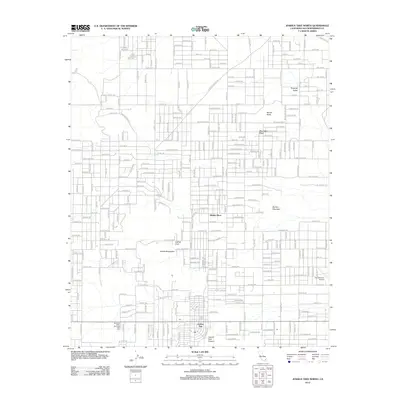
2012 Map of Joshua Tree North
USGS Topo · Published 2012About this map
Joshua Tree serves as the primary hub of this High Desert landscape, showing a dense network of residential streets named for celestial bodies and desert flora. The community structure is defined by its proximity to notable geological formations, including the Partlett Mountains and the dramatic drop into Coyote Hole Canyon to the south. Further north, the landscape transitions into more isolated settlements like Hidden River and the expansive Moonlight Mesa. This 2012 survey illustrates the unique desert suburbanization pattern where named roads such as Mercury Dr and Neptune Dr reach into the open terrain of Surprise Valley. The map also captures local aviation and memorial infrastructure, specifically the Ro Williams Airport and the Mountain Valley Memorial Park Cem, providing a detailed view of the community's established footprint before further expansion.
Find a feature on this map
58 named features on this map. Tap any name to fly to it.
Don’t see what you’re looking for? This feature index may not catch every label — zoom into the map to look around manually.
Map Details
Editions of this 2012 Joshua Tree North Map
This is the sole edition of this map. No revisions or reprints were ever made.
Other maps of this area

1953 · San Bernardino
USGS Topo · 1:250,000

1955 · Goat Mountain
USGS Topo · 1:24,000

1955 · Deadman Lake SW
USGS Topo · 1:24,000

1955 · Twentynine Palms
USGS Topo · 1:62,500

1955 · Emerson Lake
USGS Topo · 1:62,500
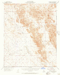
1955 · Deadman Lake
USGS Topo · 1:62,500

1955 · Joshua Tree
USGS Topo · 1:62,500

1956 · San Bernardino
USGS Topo · 1:250,000

1957 · San Bernardino
USGS Topo · 1:250,000

1958 · San Bernardino
USGS Topo · 1:250,000