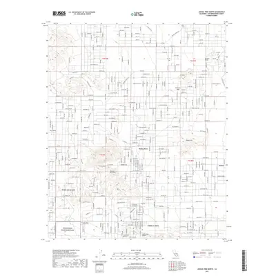
2018 Map of Joshua Tree North
USGS Topo · Published 2018About this map
The Bartlett Mountains and the northern reaches of the Mojave Desert define this high desert landscape during a period of significant residential expansion. Highlighting the 2018 geography of San Bernardino County, the map details the interconnected street networks of Yucca Valley and Joshua Tree, showing how modern developments like Yucca Mesa and Joshua Cove have filled the arid basins between rocky heights. The transition from town to wilderness is marked by landmarks such as Moonlight Mesa and Mt Nebo, while the southern margin includes the northern edge of the Twentynine Palms Main Base. Local history is anchored at the Joshua Tree Memorial Park, and the map serves as a record of the intricate road systems, from La Brisa Dr to Sunny Vista Rd, that tie these remote desert communities together.
Find a feature on this map
155 named features on this map. Tap any name to fly to it.
Don’t see what you’re looking for? This feature index may not catch every label — zoom into the map to look around manually.
Map Details
Editions of this 2018 Joshua Tree North Map
This is the sole edition of this map. No revisions or reprints were ever made.
Other maps of this area

1953 · San Bernardino
USGS Topo · 1:250,000

1955 · Goat Mountain
USGS Topo · 1:24,000

1955 · Deadman Lake SW
USGS Topo · 1:24,000

1955 · Twentynine Palms
USGS Topo · 1:62,500

1955 · Emerson Lake
USGS Topo · 1:62,500
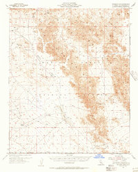
1955 · Deadman Lake
USGS Topo · 1:62,500

1955 · Joshua Tree
USGS Topo · 1:62,500

1956 · San Bernardino
USGS Topo · 1:250,000

1957 · San Bernardino
USGS Topo · 1:250,000

1958 · San Bernardino
USGS Topo · 1:250,000