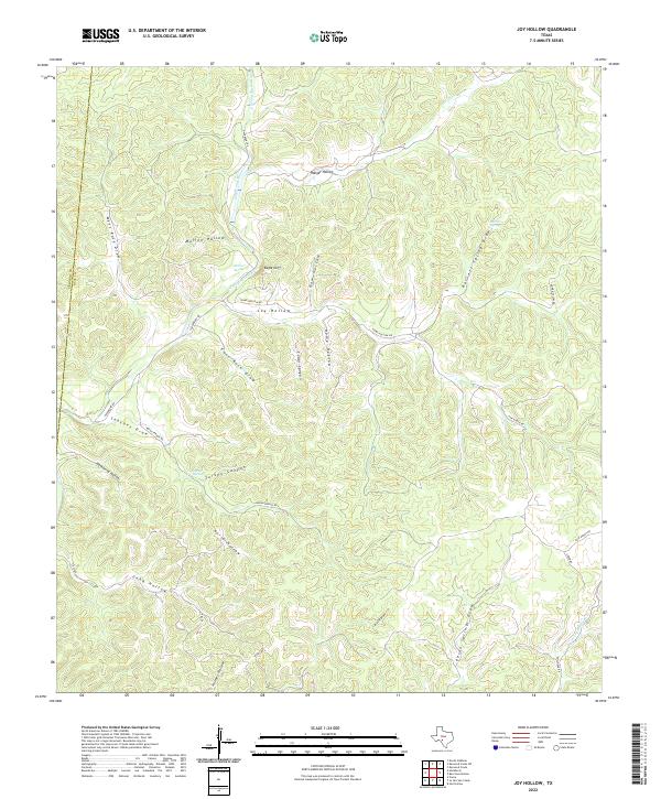
2022 Map of Joy Hollow
USGS Topo · Published 2022About this map
The E Prong Nueces River carves through the canyonlands along the Edwards Co Real Co border, revealing a landscape defined by seasonal drainages and vital water sources. This 2022 survey documents a series of named springs that have historically anchored life in this arid terrain, including Morris Spring, Barnett Spring, and Sanchez Spring. The network of draws and hollows, such as Joy Hollow and Ranger Hollow, illustrates the complex topography of the Edwards Plateau. The transition from the high relief of Eagle Cliff to the deeply incised Pecan Springs Draw and Turkey Canyon highlights the erosional forces shaping the region. Local access is marked by several ranch roads, including Home Hollow Rd and Fair Ranch Rd, which follow the natural contours of the valley floors and ridges.
Find a feature on this map
32 named features on this map. Tap any name to fly to it.
Don’t see what you’re looking for? This feature index may not catch every label — zoom into the map to look around manually.
Map Details
Editions of this 2022 Joy Hollow Map
This is the sole edition of this map. No revisions or reprints were ever made.
Other maps of this area

1893 · Rock Springs
USGS Topo · 1:125,000

1893 · Nueces
USGS Topo · 1:125,000

1896 · Nueces
USGS Topo · 1:125,000

1947 · Hackberry
USGS Topo · 1:62,500

1954 · Llano
USGS Topo · 1:250,000

1954 · San Antonio
USGS Topo · 1:250,000

1954 · Sonora
USGS Topo · 1:250,000

1955 · Llano
USGS Topo · 1:250,000

1956 · Llano
USGS Topo · 1:250,000

1957 · San Antonio
USGS Topo · 1:250,000