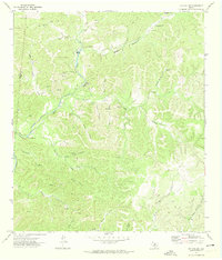
1971 Map of Joy Hollow
USGS Topo · Published 1974About this map
The Edwards Co-Real Co boundary splits this remote stretch of the Texas Hill Country, where the upper reaches of the Nueces River carve through a landscape of deep canyons and limestone features. This 1971 survey captures a period of ranching isolation, centered on large holdings like Eagle Ranch and Greenwood Valley Ranch, the latter of which features the Greenwood Valley Landing Strip as a vital link to the outside world. The terrain is defined by its complex hydrology, from the Blue Hole on the East Prong Nueces River to numerous isolated water sources like Turkey Canyon Spring and Sanchez Spring. Subterranean features are also noted, including Pape Cave and Red Arrow Cave, while the presence of the Kaolin Mine in the northwest suggests the small-scale extraction of industrial minerals in an otherwise agrarian landscape.
Find a feature on this map
35 named features on this map. Tap any name to fly to it.
Don’t see what you’re looking for? This feature index may not catch every label — zoom into the map to look around manually.
Map Details
Editions of this 1971 Joy Hollow Map
This is the sole edition of this map. No revisions or reprints were ever made.
Other maps of this area

1893 · Rock Springs
USGS Topo · 1:125,000

1893 · Nueces
USGS Topo · 1:125,000

1896 · Nueces
USGS Topo · 1:125,000

1947 · Hackberry
USGS Topo · 1:62,500

1954 · Llano
USGS Topo · 1:250,000

1954 · San Antonio
USGS Topo · 1:250,000

1954 · Sonora
USGS Topo · 1:250,000

1955 · Llano
USGS Topo · 1:250,000

1956 · Llano
USGS Topo · 1:250,000

1957 · San Antonio
USGS Topo · 1:250,000