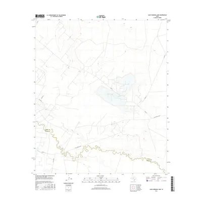
2016 Map of Juan Cordona Lake
USGS Topo · Published 2016About this map
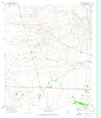
The Juan Cordona Lake basin dominates the central portion of this West Texas landscape, serving as a primary focal point for local geography and hydrology. This 2016 survey highlights the winding course of the Pecos River, which defines the boundary between Crane County and Pecos County. The river's serpentine path is paralleled by man-made infrastructure like the Highline Canal, indicating the critical nature of water management in this arid environment. The road network consists primarily of local access routes and rural lanes such as Mcmean's Ln, Tiny Earp Rd, and Old Crane Rd, reflecting the area's sparse settlement and focus on land connectivity between the river and the lake. Industrial or ranching access is further suggested by names like S Exxon Rd, which connects the interior basin to the broader regional road system including FM 1053 N.
Find a feature on this map
13 named features on this map. Tap any name to fly to it.
Don’t see what you’re looking for? This feature index may not catch every label — zoom into the map to look around manually.
Map Details
Editions of this 2016 Juan Cordona Lake Map
This is the sole edition of this map. No revisions or reprints were ever made.
Other maps of this area

1928 · Crane
USGS Topo · 1:125,000

1954 · Pecos
USGS Topo · 1:250,000

1957 · Pecos
USGS Topo · 1:250,000
1972 · Buena Vista NE
USGS Topo · 1:24,000
1972 · Buena Vista
USGS Topo · 1:24,000
1972 · Girvin NW
USGS Topo · 1:24,000

1974 · Tubbs Corner
USGS Topo · 1:24,000

1974 · Crane SW
USGS Topo · 1:24,000

1974 · Juan Cordona Lake
USGS Topo · 1:24,000
1974 · Crane NW
USGS Topo · 1:24,000