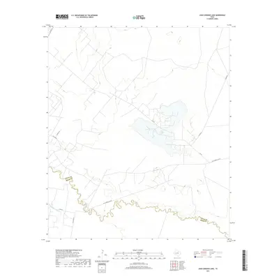
2019 Map of Juan Cordona Lake
USGS Topo · Published 2019About this map
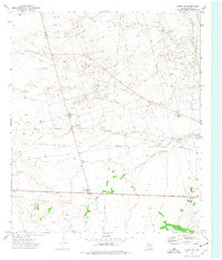
Juan Cordona Lake occupies a significant depression in this arid West Texas landscape, serving as a focal point for a network of local roads and industrial access routes. The Pecos River meanders sharply across the southern portion of the quadrangle, defining the political boundary between Crane and Pecos counties. This riparian corridor contrasts with the surrounding scrubland, which is marked by technical infrastructure including the Highline Canal. Historically significant family and industrial names appear in the local road network, such as Tiny Earp Rd, Mckean Ln, and S Exxon Rd. The terrain is characterized by subtle elevation changes and salt-basin hydrology, where the large saline lake and the irrigation-related canal suggest a landscape shaped by both natural drainage and human efforts to manage the scarce water resources of the region.
Find a feature on this map
13 named features on this map. Tap any name to fly to it.
Don’t see what you’re looking for? This feature index may not catch every label — zoom into the map to look around manually.
Map Details
Editions of this 2019 Juan Cordona Lake Map
This is the sole edition of this map. No revisions or reprints were ever made.
Other maps of this area

1928 · Crane
USGS Topo · 1:125,000

1954 · Pecos
USGS Topo · 1:250,000

1957 · Pecos
USGS Topo · 1:250,000
1972 · Buena Vista NE
USGS Topo · 1:24,000
1972 · Buena Vista
USGS Topo · 1:24,000
1972 · Girvin NW
USGS Topo · 1:24,000

1974 · Tubbs Corner
USGS Topo · 1:24,000

1974 · Crane SW
USGS Topo · 1:24,000

1974 · Juan Cordona Lake
USGS Topo · 1:24,000
1974 · Crane NW
USGS Topo · 1:24,000