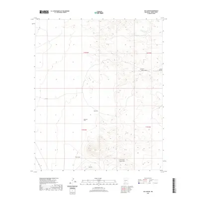
2020 Map of Jug Canyon
USGS Topo · Published 2020About this map
Nutt Mtn stands as a prominent landmark in this desert landscape of Sierra County, anchoring a terrain defined by deep drainages and dry arroyos. The map reveals a complex network of seasonal watercourses, including the notable Jug Canyon and Outlaw Canyon in the eastern reaches, which slice through the high-elevation flats. The presence of named features like Ricketson Draw and Sikes Draw suggests a history of cattle ranching or early travel routes through these arid corridors. Human activity is sparsely represented, primarily restricted to the solitary track of Co RD b011. To the south, Parks Canyon, Duran Canyon, and Tenaga Canyon converge, illustrating the severe erosional patterns that characterize this part of New Mexico. This survey provides a clear view of the natural boundaries and land divisions, documented under the Public Land Survey System for T18S and T19S.
Find a feature on this map
15 named features on this map. Tap any name to fly to it.
Don’t see what you’re looking for? This feature index may not catch every label — zoom into the map to look around manually.
Map Details
Editions of this 2020 Jug Canyon Map
This is the sole edition of this map. No revisions or reprints were ever made.
Other maps of this area

1935 · Hillsboro
USGS Topo · 1:48,000

1940 · Hillsboro
USGS Topo · 1:62,500

1955 · Las Cruces
USGS Topo · 1:250,000

1958 · Las Cruces
USGS Topo · 1:250,000

1958 · Arroyo Cuervo
USGS Topo · 1:24,000

1961 · Nutt
USGS Topo · 1:62,500

1961 · Clark Spring Canyon
USGS Topo · 1:24,000

1961 · Garfield
USGS Topo · 1:24,000

1962 · Lake Valley
USGS Topo · 1:62,500

1982 · Hatch
USGS Topo · 1:100,000