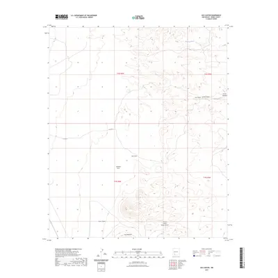
2023 Map of Jug Canyon
USGS Topo · Published 2023About this map
Nutt Mountain stands as a prominent topographical feature in this section of Sierra County, anchoring a landscape defined by an intricate network of drainage systems. The terrain is deeply incised by named canyons and draws, reflecting the complex hydrology of the high desert. To the north and east, the desert floor is carved by Arroyo Jaralosa, Arroyo Montoya, and Arroyo Cuervo, while the central and southern reaches are characterized by the steep-walled Jug Canyon and Outlaw Canyon. These features demonstrate the natural drainage patterns that flow toward lower elevations, providing a clear record of the region's geological structure. Evidence of human infrastructure is minimal, represented primarily by Co Rd B011, illustrating the sparse development in this area. Researchers can trace the path of seasonal watercourses like Sikes Draw and Ricketson Draw across the public land survey grid, which includes township lines for t18s r6w and t19s r5w.
Find a feature on this map
16 named features on this map. Tap any name to fly to it.
Don’t see what you’re looking for? This feature index may not catch every label — zoom into the map to look around manually.
Map Details
Editions of this 2023 Jug Canyon Map
This is the sole edition of this map. No revisions or reprints were ever made.
Other maps of this area

1935 · Hillsboro
USGS Topo · 1:48,000

1940 · Hillsboro
USGS Topo · 1:62,500

1955 · Las Cruces
USGS Topo · 1:250,000

1958 · Las Cruces
USGS Topo · 1:250,000

1958 · Arroyo Cuervo
USGS Topo · 1:24,000

1961 · Nutt
USGS Topo · 1:62,500

1961 · Clark Spring Canyon
USGS Topo · 1:24,000

1961 · Garfield
USGS Topo · 1:24,000

1962 · Lake Valley
USGS Topo · 1:62,500

1982 · Hatch
USGS Topo · 1:100,000