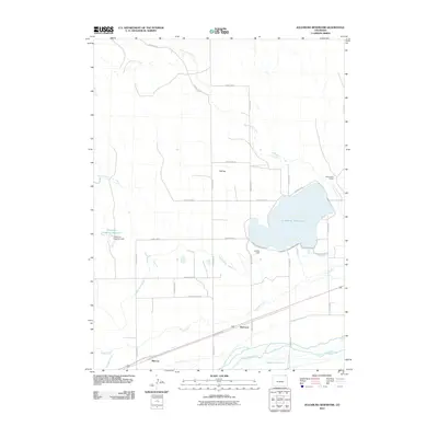
2010 Map of Julesburg Reservoir
USGS Topo · Published 2010About this map
Julesburg Reservoir dominates this Logan County landscape, serving as a vital water hub for the agricultural plains of northeast Colorado. The map reveals an intricate network of irrigation systems essential to the region's ranching and farming economy, including the Harmony Ditch Number 1, Settlers Ditch, and Long Island Ditch. These waterways parallel the course of the South Platte River, which cuts across the southern portion of the quadrangle. Small settlements and points of interest like Red Lion and Marcott are situated along the river valley, marking the historical corridor of travel and trade. In the northern reaches, the terrain rises toward Flat Top, while the presence of the Dickinson Irrigation Reservoir and the Jumbo Dam underscores the sophisticated engineering required to manage the semi-arid environment for local sites like Cottonwood Ranch.
Find a feature on this map
33 named features on this map. Tap any name to fly to it.
Don’t see what you’re looking for? This feature index may not catch every label — zoom into the map to look around manually.
Map Details
Editions of this 2010 Julesburg Reservoir Map
This is the sole edition of this map. No revisions or reprints were ever made.
Other maps of this area

1899 · Sidney
USGS Topo · 1:125,000

1952 · Marks Butte
USGS Topo · 1:24,000

1953 · Tamarack Ranch
USGS Topo · 1:24,000

1953 · Crook
USGS Topo · 1:24,000

1953 · Twin Buttes
USGS Topo · 1:24,000

1953 · Julesburg Reservoir
USGS Topo · 1:24,000

1953 · Sedgwick
USGS Topo · 1:24,000

1954 · Sterling
USGS Topo · 1:250,000

1954 · Scottsbluff
USGS Topo · 1:250,000

1958 · Scottsbluff
USGS Topo · 1:250,000