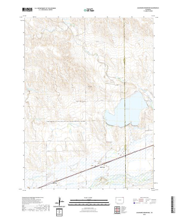
2022 Map of Julesburg Reservoir
USGS Topo · Published 2022About this map
Julesburg Reservoir dominates the landscape of eastern Logan County and western Sedgwick County, serving as a focal point for the region's complex water management system. The map reveals an intricate network of late 20th-century irrigation infrastructure, including the Harmony Ditch Number 1, Highline Canal, and Sterling Outlet Canal. These engineered waterways, alongside the South Platte River, underpin the agricultural character of the high plains near Red Lion and Marcott. North of the reservoir, the terrain transitions into the dry drainages of Cottonwood Creek and its western fork, where landmarks like Flat Top and Bolick Spring dot the landscape. The layout of county roads, such as Red Lion Road and Co RD 138, reflects a rural settlement pattern deeply tied to both the river valley and the storage capacity of the Dickinson Irrigation Reservoir.
Find a feature on this map
43 named features on this map. Tap any name to fly to it.
Don’t see what you’re looking for? This feature index may not catch every label — zoom into the map to look around manually.
Map Details
Editions of this 2022 Julesburg Reservoir Map
This is the sole edition of this map. No revisions or reprints were ever made.
Other maps of this area

1899 · Sidney
USGS Topo · 1:125,000

1952 · Marks Butte
USGS Topo · 1:24,000

1953 · Tamarack Ranch
USGS Topo · 1:24,000

1953 · Crook
USGS Topo · 1:24,000

1953 · Twin Buttes
USGS Topo · 1:24,000

1953 · Julesburg Reservoir
USGS Topo · 1:24,000

1953 · Sedgwick
USGS Topo · 1:24,000

1954 · Sterling
USGS Topo · 1:250,000

1954 · Scottsbluff
USGS Topo · 1:250,000

1958 · Scottsbluff
USGS Topo · 1:250,000