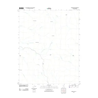
2012 Map of Jumbo Peak
USGS Topo · Published 2012About this map
Scanlon Dugway provides a specialized route through the drainage networks of eastern Clark County, descending toward the lower elevations of Scanlon Wash and Gregg Wash. This arid landscape is defined by its vertical relief, anchored by high points such as Jumbo Peak, Rattlesnake Peak, and Bonelli Peak. Water sources are critical but intermittent, appearing as scattered springs including Gotchel Spring, Jumbo Spring, and Twin Springs. The network of names like Cataract Wash and Goat Camp Wash implies a long history of seasonal water management and grazing routes. Terrain features such as Jumbo Basin and Garnet Valley break the ridgelines of Anderson Ridge, revealing a complex geological profile centered on the Virgin River's broader watershed.
Find a feature on this map
27 named features on this map. Tap any name to fly to it.
Don’t see what you’re looking for? This feature index may not catch every label — zoom into the map to look around manually.
Map Details
Editions of this 2012 Jumbo Peak Map
This is the sole edition of this map. No revisions or reprints were ever made.
Other maps of this area

1886 · Saint Thomas
USGS Topo · 1:250,000

1893 · Saint Thomas
USGS Topo · 1:250,000

1926 · Bonelli
USGS Topo · 1:96,000

1953 · Overton Beach
USGS Topo · 1:62,500

1953 · Iceberg Canyon
USGS Topo · 1:62,500

1953 · Gold Butte
USGS Topo · 1:62,500

1953 · Virgin Basin
USGS Topo · 1:62,500

1954 · Las Vegas
USGS Topo · 1:250,000

1957 · Las Vegas
USGS Topo · 1:250,000

1959 · Las Vegas
USGS Topo · 1:250,000