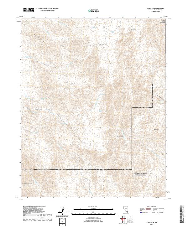
2021 Map of Jumbo Peak
USGS Topo · Published 2021About this map
The South Virgin Mountains dominate this high-desert terrain where the Colorado River basin meets the Mojave. Centered on Jumbo Peak and its surrounding Jumbo Basin, the landscape is defined by a network of seasonal washes and isolated springs that once sustained travelers through this arid corridor. To the south, the boundary of the Lake Mead National Recreation Area indicates the region's transition into federally managed lands, protecting the rugged approach to the canyon country.
Find a feature on this map
38 named features on this map. Tap any name to fly to it.
Don’t see what you’re looking for? This feature index may not catch every label — zoom into the map to look around manually.
Map Details
Editions of this 2021 Jumbo Peak Map
This is the sole edition of this map. No revisions or reprints were ever made.
Other maps of this area

1886 · Saint Thomas
USGS Topo · 1:250,000

1893 · Saint Thomas
USGS Topo · 1:250,000

1926 · Bonelli
USGS Topo · 1:96,000

1953 · Overton Beach
USGS Topo · 1:62,500

1953 · Iceberg Canyon
USGS Topo · 1:62,500

1953 · Gold Butte
USGS Topo · 1:62,500

1953 · Virgin Basin
USGS Topo · 1:62,500

1954 · Las Vegas
USGS Topo · 1:250,000

1957 · Las Vegas
USGS Topo · 1:250,000

1959 · Las Vegas
USGS Topo · 1:250,000