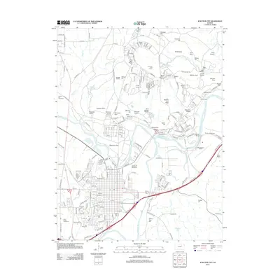
2012 Map of Junction City
USGS Topo · Published 2012About this map
Junction City sits at the significant confluence where the Republican River and the Smoky Hill River join to form the Kansas River. This 2012 survey illustrates the deep integration of military and civil infrastructure in the region, with Marshall Army Airfield and Camp Whiteside dominating the eastern landscape. The city grid is clearly defined, featuring local landmarks such as Rathert Stadium and the Geary County Fairgrounds. To the south, the topography transitions toward Grand View Hill and Franks Hill, while the northern reaches are marked by training grounds and ridges such as Machine Gun Ridge and Artillery Hill. Genealogists will find the locations of Highland Cem and Saint Marys Cem preserved, providing clear spatial context for local family history research within the urban boundary.
Find a feature on this map
204 named features on this map. Tap any name to fly to it.
Don’t see what you’re looking for? This feature index may not catch every label — zoom into the map to look around manually.
Map Details
Editions of this 2012 Junction City Map
This is the sole edition of this map. No revisions or reprints were ever made.
Other maps of this area

1886 · Junction City
USGS Topo · 1:125,000

1889 · Junction City
USGS Topo · 1:125,000

1889 · Parkerville
USGS Topo · 1:125,000

1894 · Junction City
USGS Topo · 1:125,000

1894 · Parkerville
USGS Topo · 1:125,000

1947 · Manhattan
USGS Topo · 1:62,500

1947 · Fort Riley
USGS Topo · 1:62,500

1950 · Keats
USGS Topo · 1:24,000

1950 · Junction City
USGS Topo · 1:24,000

1950 · Alida
USGS Topo · 1:24,000