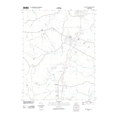
2010 Map of Junction City
USGS Topo · Published 2010About this map
Junction City serves as a central hub on this map, situated where numerous roads and rail lines converge in southern Boyle County. The settlement pattern follows the local topography, with several named knobs such as Persimmon Knob, Catholic Knob, and Gibson Knob rising above the surrounding creek basins. Waterways like White Oak Creek, Knoblick Creek, and Harris Creek branch across the landscape, while the Salt River appears in the northwest corner. This 2010 survey illustrates the continued importance of regional transit, anchored by Stuart Powell Field and the dense network of rural routes like Alum Springs-Crosspike and Hustonville Rd. Local history is preserved in numerous family and community burial grounds, including Gray Cemetery, Sandidge Cemetery, and Pruitt Cemetery, which are scattered between smaller clusters of population like Alum Springs, Milledgeville, and Moreland.
Find a feature on this map
62 named features on this map. Tap any name to fly to it.
Don’t see what you’re looking for? This feature index may not catch every label — zoom into the map to look around manually.
Map Details
Editions of this 2010 Junction City Map
This is the sole edition of this map. No revisions or reprints were ever made.
Other maps of this area

1905 · Harrodsburg
USGS Topo · 1:125,000

1950 · Bryantsville
USGS Topo · 1:24,000

1952 · Perryville
USGS Topo · 1:24,000

1952 · Ellisburg
USGS Topo · 1:24,000

1952 · Halls Gap
USGS Topo · 1:24,000

1952 · Hustonville
USGS Topo · 1:24,000

1952 · Danville
USGS Topo · 1:24,000

1952 · Bryantsville
USGS Topo · 1:24,000

1952 · Stanford
USGS Topo · 1:24,000

1952 · Junction City
USGS Topo · 1:24,000