
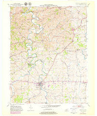
1952 Map of Perryville
USGS Topo · Published 1953About this map
Perryville Battlefield State Park serves as a focal point for the history of this region, preserving the site where the landscape's high ridges and river bends once dictated military movement. This 1952 topographic record shows the Chaplin River winding deeply through the terrain, separating the town of Perryville from the sprawling farmland to the north. The boundary between Mercer Co and Boyle Co cuts across a network of rural roads that connect small communities like Nevada and Dixville.
Find a feature on this map
29 named features on this map. Tap any name to fly to it.
Don’t see what you’re looking for? This feature index may not catch every label — zoom into the map to look around manually.
Map Details
Editions of this 1952 Perryville Map
2 editions found
Other maps of this area

1905 · Harrodsburg
USGS Topo · 1:125,000

1952 · Danville
USGS Topo · 1:24,000

1952 · Harrodsburg
USGS Topo · 1:24,000

1952 · Cornishville
USGS Topo · 1:24,000

1952 · Junction City
USGS Topo · 1:24,000

1952 · Parksville
USGS Topo · 1:24,000

1953 · Mackville
USGS Topo · 1:24,000

1953 · Gravel Switch
USGS Topo · 1:24,000

1953 · Cardwell
USGS Topo · 1:24,000

1957 · Winchester
USGS Topo · 1:250,000