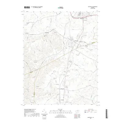
2019 Map of Junction City
USGS Topo · Published 2019About this map
Junction City and Shelby City serve as the central hubs of this 2019 survey, where the Norfolk Southern railroad line cuts through the heart of the region. The landscape is defined by a dense series of named knobs, including Boyle Knob, Sand Knob, and Persimmon Knob, which rise above the complex network of creeks such as White Oak Cr and Knoblick Cr. This modern topographic detail allows for a precise study of how historic settlements like Milledgeville and Moreland have integrated into the rural infrastructure of Boyle and Lincoln counties. Genealogists will find particular value in the numerous family and community burial grounds documented here, from Gray Cem in the north to Pruitt Cem near the southern border. The presence of Stuart Powell Field northeast of the junction highlights the area's continued role as a regional transportation corridor.
Find a feature on this map
129 named features on this map. Tap any name to fly to it.
Don’t see what you’re looking for? This feature index may not catch every label — zoom into the map to look around manually.
Map Details
Editions of this 2019 Junction City Map
This is the sole edition of this map. No revisions or reprints were ever made.
Other maps of this area

1905 · Harrodsburg
USGS Topo · 1:125,000

1950 · Bryantsville
USGS Topo · 1:24,000

1952 · Perryville
USGS Topo · 1:24,000

1952 · Ellisburg
USGS Topo · 1:24,000

1952 · Halls Gap
USGS Topo · 1:24,000

1952 · Hustonville
USGS Topo · 1:24,000

1952 · Danville
USGS Topo · 1:24,000

1952 · Bryantsville
USGS Topo · 1:24,000

1952 · Stanford
USGS Topo · 1:24,000

1952 · Junction City
USGS Topo · 1:24,000