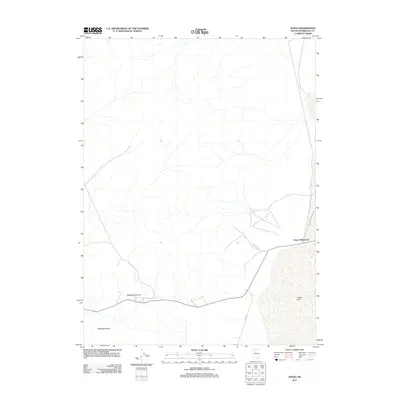
2011 Map of Jungo
USGS Topo · Published 2011About this map
Jungo (Historical) anchors this high-desert landscape in Humboldt County, representing a former settlement site at the edge of the expansive Jungo Flat. This 2011 survey details a region defined by its wide, open basins and significant elevation changes, notably at Antelope Summit within the Antelope Range. The map illustrates the sparse infrastructure of the area, centered on the junction of Bottle Creek Rd and Ely Rd. These routes provide the primary access through the desert floor, tracing a path that connects the historical remains of Jungo with the surrounding peaks and valleys. The absence of modern development highlights the preserved state of this desert corridor, making it a valuable resource for those studying the physical geography and remnants of early 20th-century Nevada outposts.
Find a feature on this map
6 named features on this map. Tap any name to fly to it.
Don’t see what you’re looking for? This feature index may not catch every label — zoom into the map to look around manually.
Map Details
Editions of this 2011 Jungo Map
This is the sole edition of this map. No revisions or reprints were ever made.
Other maps of this area

1886 · Disaster
USGS Topo · 1:250,000

1893 · Disaster
USGS Topo · 1:250,000

1931 · Lovelock
USGS Topo · 1:250,000

1935 · Lovelock
USGS Topo · 1:250,000

1954 · Vya
USGS Topo · 1:250,000

1955 · Lovelock
USGS Topo · 1:250,000

1958 · Vya
USGS Topo · 1:250,000

1959 · Lovelock
USGS Topo · 1:250,000

1962 · Vya
USGS Topo · 1:250,000

1966 · Donna Schee Peak
USGS Topo · 1:62,500