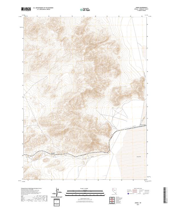
2021 Map of Jungo
USGS Topo · Published 2021About this map
Antelope Summit stands as a central topographic landmark in this section of the Great Basin, where the high ground transitions into the expansive Desert Valley to the east. The landscape is defined by the stark divide between the upland ridges and the low-lying Jungo Flat, a characteristic basin-and-range formation in Humboldt County. Connectivity across this arid terrain is maintained by Jungo Rd, which cuts through the southern portion of the quadrangle, and Bottle Creek Rd skirting the eastern edge of the mountains. This 2021 edition reflects the enduring isolation of the region, where surveying lines for T36N and T35N mark out vast stretches of public land with very few permanent structures or developed sites, preserving the primitive character of the Nevada desert.
Find a feature on this map
9 named features on this map. Tap any name to fly to it.
Don’t see what you’re looking for? This feature index may not catch every label — zoom into the map to look around manually.
Map Details
Editions of this 2021 Jungo Map
This is the sole edition of this map. No revisions or reprints were ever made.
Other maps of this area

1886 · Disaster
USGS Topo · 1:250,000

1893 · Disaster
USGS Topo · 1:250,000

1931 · Lovelock
USGS Topo · 1:250,000

1935 · Lovelock
USGS Topo · 1:250,000

1954 · Vya
USGS Topo · 1:250,000

1955 · Lovelock
USGS Topo · 1:250,000

1958 · Vya
USGS Topo · 1:250,000

1959 · Lovelock
USGS Topo · 1:250,000

1962 · Vya
USGS Topo · 1:250,000

1966 · Donna Schee Peak
USGS Topo · 1:62,500