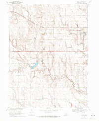
1969 Map of Juniata
USGS Topo · Published 1972About this map
Juniata sits at the northern edge of this Adams County landscape, a community defined by its proximity to the Burlington Northern railroad corridor. The area's agricultural character is evident in the network of section lines and field divisions, many of which are marked by the Cottonwood and Juniata township boundaries. The terrain is drained by a complex system of waterways, most notably Thirtyone Mile Creek and its tributary, the West Branch Thirtyone Mile Creek, which meander through the southern half of the quadrangle.
Find a feature on this map
16 named features on this map. Tap any name to fly to it.
Don’t see what you’re looking for? This feature index may not catch every label — zoom into the map to look around manually.
Map Details
Editions of this 1969 Juniata Map
This is the sole edition of this map. No revisions or reprints were ever made.
Other maps of this area

1894 · Kenesaw
USGS Topo · 1:62,500

1896 · Wood River
USGS Topo · 1:125,000

1897 · Red Cloud
USGS Topo · 1:125,000

1898 · Superior
USGS Topo · 1:125,000

1898 · Grand Island
USGS Topo · 1:125,000

1955 · Grand Island
USGS Topo · 1:250,000

1957 · Grand Island
USGS Topo · 1:250,000

1958 · Grand Island
USGS Topo · 1:250,000

1962 · Denman
USGS Topo · 1:24,000

1962 · Prosser
USGS Topo · 1:24,000