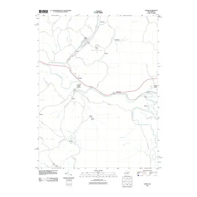
2010 Map of Junior
USGS Topo · Published 2010About this map
The Tygart Valley River snakes through the heart of this landscape, serving as the central axis for a string of mountain communities. Early 21st-century infrastructure connects towns like Junior, Dartmoor, and Harding along the riverbanks, while the southern reaches of the quadrangle are anchored by the settlements of Coalton and Mabie. For those researching local history, the map identifies specific community landmarks such as the Norton Post Office and the Mabie Post Office, alongside the Mountain View Cemetery.
Find a feature on this map
61 named features on this map. Tap any name to fly to it.
Don’t see what you’re looking for? This feature index may not catch every label — zoom into the map to look around manually.
Map Details
Editions of this 2010 Junior Map
This is the sole edition of this map. No revisions or reprints were ever made.
Other maps of this area

1886 · St. George
USGS Topo · 1:125,000

1889 · Beverly
USGS Topo · 1:125,000

1891 · St. George
USGS Topo · 1:125,000

1892 · Beverly
USGS Topo · 1:125,000

1893 · Buckhannon
USGS Topo · 1:125,000

1896 · Buckhannon
USGS Topo · 1:125,000

1897 · Buckhannon
USGS Topo · 1:125,000

1904 · Philippi
USGS Topo · 1:62,500

1907 · Belington
USGS Topo · 1:62,500

1909 · Elkins
USGS Topo · 1:62,500