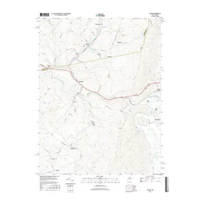
2016 Map of Junior
USGS Topo · Published 2016About this map
The Tygart Valley River carves a deep path through the heart of the Tygart Valley, flanked by the prominent heights of Laurel Mtn and Rich Mtn. This 2016 survey documents the enduring settlement patterns of Barbour and Randolph Counties, where communities like Junior and Norton are tied to the river's course. Historically significant water sources, including the Town of Junior Spring and Denver Lee Shomer Spring, remain documented alongside family-named landmarks like the Norton Bridge. The map details the transition from small river towns like Dartmoor and Gage to the rising terrain of Broad Hollow. Local history is anchored at sites such as Mountain View Cem, while the industrial legacy of the region is reflected in the layout of Coalton and Mabie situated along the southern drainage of Roaring Cr.
Find a feature on this map
95 named features on this map. Tap any name to fly to it.
Don’t see what you’re looking for? This feature index may not catch every label — zoom into the map to look around manually.
Map Details
Editions of this 2016 Junior Map
This is the sole edition of this map. No revisions or reprints were ever made.
Other maps of this area

1886 · St. George
USGS Topo · 1:125,000

1889 · Beverly
USGS Topo · 1:125,000

1891 · St. George
USGS Topo · 1:125,000

1892 · Beverly
USGS Topo · 1:125,000

1893 · Buckhannon
USGS Topo · 1:125,000

1896 · Buckhannon
USGS Topo · 1:125,000

1897 · Buckhannon
USGS Topo · 1:125,000

1904 · Philippi
USGS Topo · 1:62,500

1907 · Belington
USGS Topo · 1:62,500

1909 · Elkins
USGS Topo · 1:62,500