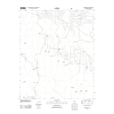
2012 Map of Juniper Hills
USGS Topo · Published 2012About this map
Juniper Hills and the surrounding high desert canyonlands are defined by a complex intersection of historic ranching and modern water infrastructure. The Governor Edmund G Brown California Aqueduct cuts across the northern landscape, a testament to the region's role in the state's hydraulic engineering. Settlement patterns here remain rooted in family-named holdings such as Saunders Ranch, Stanton Ranch, and Burkhart Ranch, many of which are situated near the seasonal drainages of Little Rock Cr and Pallett Cr. The presence of Butterfield Stage Rd hints at the area's older history as a transit corridor. To the south, the terrain rises sharply toward the San Gabriel peaks, where Will Thrall Peak and Pallett Mountain overlook primitive recreational sites like Little Cedars Campground and Sycamore Campground.
Find a feature on this map
84 named features on this map. Tap any name to fly to it.
Don’t see what you’re looking for? This feature index may not catch every label — zoom into the map to look around manually.
Map Details
Editions of this 2012 Juniper Hills Map
This is the sole edition of this map. No revisions or reprints were ever made.
Other maps of this area

1900 · Tujunga
USGS Topo · 1:62,500

1901 · Southern California Sheet No. 1
USGS Topo · 1:250,000

1903 · Rock Creek
USGS Topo · 1:62,500

1904 · Southern California Sheet No. 1
USGS Topo · 1:250,000

1915 · Elizabeth Lake
USGS Topo · 1:125,000

1917 · Elizabeth Lake
USGS Topo · 1:125,000

1930 · Little Rock
USGS Topo · 1:24,000

1930 · Llano
USGS Topo · 1:24,000

1930 · Pearland
USGS Topo · 1:24,000

1934 · Pearland
USGS Topo · 1:24,000