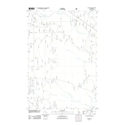
2011 Map of Juniper
USGS Topo · Published 2011About this map
Juniper and the neighboring settlements of Doty and Evelyn sit within a landscape defined by the intricate hydrology of Michigan’s Upper Peninsula. The northern reaches are anchored by Wetmore Lake and the prominent Wetmore Lookout Tower, while the southern portion is crossed by the Little Indian River and multiple branches of Stutts Creek. The road network, including Co Rd 646 and Chamberlain Rd, reveals a pattern of dispersed rural residential development and forest management. This era of land use is further illustrated by the presence of Hanley Field and the Munising Sanitary Landfill. Researchers will find a detailed representation of the region's hydrography, from the isolated Garvey Ponds to the meandering Middle Branch Stutts Creek and Stump Lake, reflecting the natural drainage patterns that have shaped Alger County's development and transportation corridors over time.
Find a feature on this map
24 named features on this map. Tap any name to fly to it.
Don’t see what you’re looking for? This feature index may not catch every label — zoom into the map to look around manually.
Map Details
Editions of this 2011 Juniper Map
This is the sole edition of this map. No revisions or reprints were ever made.
Other maps of this area

1931 · Shingleton SW
USGS Topo · 1:31,680

1931 · Steuben NW
USGS Topo · 1:31,680

1931 · Skeels Lake NE
USGS Topo · 1:31,680

1931 · Munising SE
USGS Topo · 1:31,680

1958 · Corner Lake
USGS Topo · 1:62,500

1958 · Munising
USGS Topo · 1:62,500

1958 · Shingleton
USGS Topo · 1:62,500
1958 · Steuben
USGS Topo · 1:62,500

1958 · Marquette
USGS Topo · 1:250,000

1960 · Marquette
USGS Topo · 1:250,000