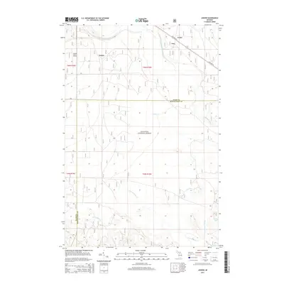
2014 Map of Juniper
USGS Topo · Published 2014About this map
The Hiawatha National Forest dominates this landscape in the Upper Peninsula, where the forest floor is defined by a dense network of watercourses. The drainage of the North Branch Stutts Creek and its various tributaries, including the Middle Br Stutts Cr and South Br Stutts Cr, reveal the intricate hydrology south of the Lake Superior watershed. Small settlements like Juniper and Doty are situated along State Hwy 28, which serves as the primary east-west artery through this timber-rich region. To the north, the terrain near Evelyn and the Hanley Field Airport provides a point of aviation access amidst the wilderness. The map also captures the boundary between Alger and Schoolcraft counties, marking where local jurisdictions meet in the heart of the Michigan forest, surrounded by isolated water bodies like Stump Lake and the meandering Little Indian River.
Find a feature on this map
20 named features on this map. Tap any name to fly to it.
Don’t see what you’re looking for? This feature index may not catch every label — zoom into the map to look around manually.
Map Details
Editions of this 2014 Juniper Map
This is the sole edition of this map. No revisions or reprints were ever made.
Other maps of this area

1931 · Shingleton SW
USGS Topo · 1:31,680

1931 · Steuben NW
USGS Topo · 1:31,680

1931 · Skeels Lake NE
USGS Topo · 1:31,680

1931 · Munising SE
USGS Topo · 1:31,680

1958 · Corner Lake
USGS Topo · 1:62,500

1958 · Munising
USGS Topo · 1:62,500

1958 · Shingleton
USGS Topo · 1:62,500
1958 · Steuben
USGS Topo · 1:62,500

1958 · Marquette
USGS Topo · 1:250,000

1960 · Marquette
USGS Topo · 1:250,000