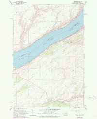
1962 Map of Juniper
USGS Topo · Published 1978About this map
Lake Wallula dominates this reach of the Columbia River, where the state line divides Washington and Oregon. This stretch is a critical transportation corridor, defined by the parallel tracks of the Spokane Portland and Seattle railroad on the northern bank and the Union Pacific line to the south. The small settlement of Juniper sits along the southern shore, positioned near the mouth of Juniper Canyon. The surrounding terrain is marked by deep coulees like Switzer Canyon and Cold Springs Canyon, which cut through the high plateau. Infrastructure such as a Substation, Storage Bins, and a remote Landing Strip reflect the logistical and agricultural character of Umatilla County in the early 1960s. Historical traces like a Jeep Trail and the Pipeline offer insight into the mid-century development of this arid river landscape.
Find a feature on this map
18 named features on this map. Tap any name to fly to it.
Don’t see what you’re looking for? This feature index may not catch every label — zoom into the map to look around manually.
Map Details
Editions of this 1962 Juniper Map
2 editions found

Other maps of this area

1908 · Umatilla
USGS Topo · 1:125,000

1915 · Wallulah
USGS Topo · 1:96,000

1917 · Pasco
USGS Topo · 1:125,000

1918 · Wallula
USGS Topo · 1:125,000

1935 · Pendleton
USGS Topo · 1:125,000

1953 · Pendleton
USGS Topo · 1:250,000

1953 · Walla Walla
USGS Topo · 1:250,000

1956 · Pendleton
USGS Topo · 1:250,000

1958 · Walla Walla
USGS Topo · 1:250,000

1962 · Hat Rock
USGS Topo · 1:24,000