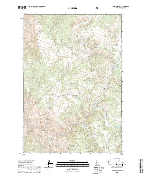
2024 Map of Jureano Mountain
USGS Topo · Published 2024About this map
Salmon National Forest defines the character of this mountainous Idaho landscape, where the drainage systems of Arnett Creek and Napias Creek converge amidst steep gulches and ridges. The topography is marked by several prominent family-named and geographic landmarks, including Jureano Mtn in the northwest and Leacock Point to the south. Historically significant features like California Bar suggest a legacy of placer mining, while the White Horse Basin highlights the complex natural basins found throughout the Lemhi County backcountry.
Find a feature on this map
44 named features on this map. Tap any name to fly to it.
Don’t see what you’re looking for? This feature index may not catch every label — zoom into the map to look around manually.
Map Details
Editions of this 2024 Jureano Mountain Map
This is the sole edition of this map. No revisions or reprints were ever made.
Other maps of this area

1950 · Blackbird Mtn
USGS Topo · 1:62,500

1950 · Leesburg
USGS Topo · 1:62,500

1951 · Leesburg
USGS Topo · 1:62,500

1951 · Blackbird Mtn
USGS Topo · 1:62,500

1956 · Elk City
USGS Topo · 1:250,000

1960 · Elk City
USGS Topo · 1:250,000

1960 · Ulysses Mtn
USGS Topo · 1:62,500

1960 · Shoup
USGS Topo · 1:62,500

1982 · Bighorn Crags
USGS Topo · 1:100,000
1989 · Leesburg
USGS Topo · 1:24,000