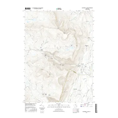
2016 Map of Kaaterskill Clove
USGS Topo · Published 2016About this map
Haines Falls and Palenville anchor this survey of the high peaks and dramatic ravines where the Eastern Catskills drop toward the Hudson Valley. The terrain is defined by extreme relief, featuring landmarks like Artists Rock and Rip Van Winkle Hollow alongside deep cuts such as Santa Cruz Ravine and Wildcat Ravine. The drainage of Kaaterskill Creek and the famous Kaaterskill Falls demonstrate the area's geography, which transitions into the southern settlements of Platte Clove and Manorville. Genealogists will find several burial grounds noted, including the Palenville Village Cemetery and Goodwin Cemetery. The map also captures specialized enclaves like Twilight Park and Ledgewood Park, which reflect the region's development as a retreat. From the high elevation of Stoppel Point to the Devils Kitchen, the intricate contour lines illustrate a landscape that has long challenged travelers and inspired local folklore.
Find a feature on this map
97 named features on this map. Tap any name to fly to it.
Don’t see what you’re looking for? This feature index may not catch every label — zoom into the map to look around manually.
Map Details
Editions of this 2016 Kaaterskill Clove Map
This is the sole edition of this map. No revisions or reprints were ever made.
Other maps of this area

1892 · Kaaterskill
USGS Topo · 1:62,500

1893 · Kaaterskill
USGS Topo · 1:62,500

1893 · Coxsackie
USGS Topo · 1:62,500

1893 · Durham
USGS Topo · 1:62,500

1894 · Coxsackie
USGS Topo · 1:62,500

1894 · Kaaterskill
USGS Topo · 1:62,500

1894 · Durham
USGS Topo · 1:62,500

1895 · Catskill
USGS Topo · 1:62,500

1899 · Kaaterskill
USGS Topo · 1:62,500

1903 · Kaaterskill
USGS Topo · 1:62,500