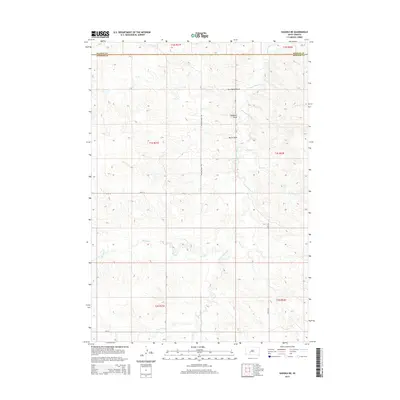
2015 Map of Kadoka NE
USGS Topo · Published 2015About this map
The rolling grasslands of Jackson County and southern Haakon County are defined by a complex network of ephemeral drainage systems and section-line roads in this 2015 U.S. Geological Survey topographic study. The landscape is carved by numerous draws and creeks that form the headwaters of regional tributaries, including the extensive White Willow Cr and its associated landmarks like Butte Draw and Bushnell Draw. The map illustrates the rigid grid of the Public Land Survey System, where infrastructure such as Willow Creek Rd, 239th St, and 229th Ave follows the boundaries of townships like t1s r21e and t1s r22e. This layout reveals the persistent cattle-ranching and agricultural organization of the South Dakota plains, where water sources like Brady Cr and Busy Cr remain central to land utility.
Find a feature on this map
20 named features on this map. Tap any name to fly to it.
Don’t see what you’re looking for? This feature index may not catch every label — zoom into the map to look around manually.
Map Details
Editions of this 2015 Kadoka NE Map
This is the sole edition of this map. No revisions or reprints were ever made.
Other maps of this area

1950 · Weta
USGS Topo · 1:24,000

1951 · Kadoka
USGS Topo · 1:24,000

1951 · Belvidere SW
USGS Topo · 1:24,000

1953 · Philip Junction
USGS Topo · 1:24,000

1953 · Philip
USGS Topo · 1:24,000

1953 · Philip SE
USGS Topo · 1:24,000

1954 · Belvidere NW
USGS Topo · 1:24,000

1954 · Kadoka NE
USGS Topo · 1:24,000

1954 · Powell
USGS Topo · 1:24,000

1954 · Pierre
USGS Topo · 1:250,000