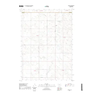
2017 Map of Kadoka NE
USGS Topo · Published 2017About this map
The boundary between Haakon County and Jackson County bisects this West River landscape, defined by a network of seasonal drainages and draws that carve through the high plains. The topography is dominated by the erosion patterns of the White Willow Creek and Brady Creek systems, which flow through sparsely populated sections of the Great Plains. A series of named draws, including Kerrington Draw and Bushnell Draw, indicate the rugged localized relief that characterizes this ranching country.
Find a feature on this map
21 named features on this map. Tap any name to fly to it.
Don’t see what you’re looking for? This feature index may not catch every label — zoom into the map to look around manually.
Map Details
Editions of this 2017 Kadoka NE Map
This is the sole edition of this map. No revisions or reprints were ever made.
Other maps of this area

1950 · Weta
USGS Topo · 1:24,000

1951 · Kadoka
USGS Topo · 1:24,000

1951 · Belvidere SW
USGS Topo · 1:24,000

1953 · Philip Junction
USGS Topo · 1:24,000

1953 · Philip
USGS Topo · 1:24,000

1953 · Philip SE
USGS Topo · 1:24,000

1954 · Belvidere NW
USGS Topo · 1:24,000

1954 · Kadoka NE
USGS Topo · 1:24,000

1954 · Powell
USGS Topo · 1:24,000

1954 · Pierre
USGS Topo · 1:250,000