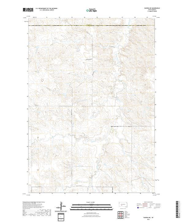
2021 Map of Kadoka NE
USGS Topo · Published 2021About this map
White Willow Cr and Busy Cr meander through this section of the western South Dakota plains, defining a landscape shaped by intermittent watercourses and deep draws. Located along the boundary of Haakon and Jackson counties, the terrain is marked by significant topographical depressions such as Bushnell Draw and Kerrington Draw, which serve as natural drainage paths toward the larger creek systems.
Find a feature on this map
19 named features on this map. Tap any name to fly to it.
Don’t see what you’re looking for? This feature index may not catch every label — zoom into the map to look around manually.
Map Details
Editions of this 2021 Kadoka NE Map
This is the sole edition of this map. No revisions or reprints were ever made.
Other maps of this area

1950 · Weta
USGS Topo · 1:24,000

1951 · Kadoka
USGS Topo · 1:24,000

1951 · Belvidere SW
USGS Topo · 1:24,000

1953 · Philip Junction
USGS Topo · 1:24,000

1953 · Philip
USGS Topo · 1:24,000

1953 · Philip SE
USGS Topo · 1:24,000

1954 · Belvidere NW
USGS Topo · 1:24,000

1954 · Kadoka NE
USGS Topo · 1:24,000

1954 · Powell
USGS Topo · 1:24,000

1954 · Pierre
USGS Topo · 1:250,000