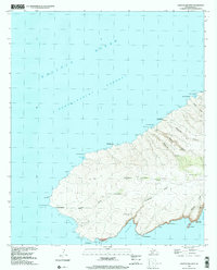
1991 Map of Kahoolawe West
USGS Topo · Published 2001About this map
The western coastline of Kaho‘olawe, situated across the Kealaikahiki Channel in the Makawao District, is defined by dramatic volcanic features and deep gulches. This 1991 photo-inspection reveals a landscape shaped by coastal indentations like Honoko‘a Bay and Ahupū Bay, while the interior is marked by significant volcanic craters including Lua ‘O Keaualuna and Lua ‘O Keālialalo. Modern infrastructure is sparse, restricted primarily to the US Coast Guard Reservation near Southwest Point Light and a specialized Heliport and Communication Tower near Pu‘ukahua. Deep drainages such as Ahupū Gulch and Waikahalulu Gulch dominate the topography, reflecting the erosional patterns of this island. The presence of traditional Hawaiian place names like Keanakeiki and Honukanai‘a underscores the long-standing cultural geography of the island before and during its late 20th-century status.
Find a feature on this map
41 named features on this map. Tap any name to fly to it.
Don’t see what you’re looking for? This feature index may not catch every label — zoom into the map to look around manually.
Map Details
Editions of this 1991 Kahoolawe West Map
This is the sole edition of this map. No revisions or reprints were ever made.
Other maps of this area

1929 · Kahoolawe
USGS Topo · 1:62,500

1954 · Maui
USGS Topo · 1:250,000

1966 · Maui
USGS Topo · 1:250,000

1974 · Maui
USGS Topo · 1:250,000
1984 · Kahoolawe
USGS Topo · 1:25,000
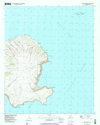
1991 · Kahoolawe East
USGS Topo · 1:24,000
2013 · Kahoolawe OE W
USGS Topo · 1:24,000
2013 · Kahoolawe OE N
USGS Topo · 1:24,000
2013 · Kahoolawe
USGS Topo · 1:24,000
2017 · Kahoolawe OE W
USGS Topo · 1:24,000