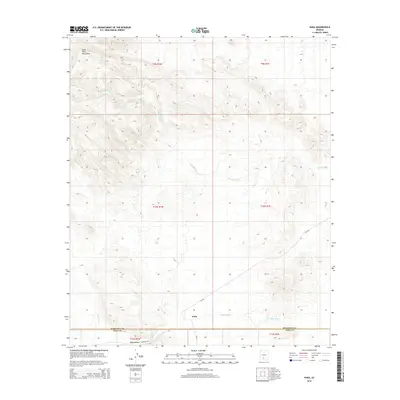
2014 Map of Kaka
USGS Topo · Published 2014About this map
The settlement of Kaka serves as the focal point for this desert landscape, situated at a junction where modern infrastructure meets the ancient drainage systems of the Sonoran region. Located near the Maricopa Co Pima Co boundary line, the area is defined by the broad Kaka Valley and the prominent Sano Tank Mountains to the northwest. This 2014 survey documents a network of Bureau of Indian Affairs routes, including Bia-342 and Bia-23, which provide access through the arid terrain. The map records the natural hydrology of the basin, dominated by the intermittent Kohatk Wash and Kaka Wash. The inclusion of Pipeline Rd underscores the utility-based development of the valley, while the detailed topography illustrates how human habitation and transportation routes have been shaped by the presence of these seasonal washes and mountain foothills.
Find a feature on this map
15 named features on this map. Tap any name to fly to it.
Don’t see what you’re looking for? This feature index may not catch every label — zoom into the map to look around manually.
Map Details
Editions of this 2014 Kaka Map
This is the sole edition of this map. No revisions or reprints were ever made.
Other maps of this area

1941 · Vekol Mountains
USGS Topo · 1:62,500

1942 · Vekol Mountains
USGS Topo · 1:62,500

1953 · Ajo
USGS Topo · 1:250,000

1957 · Ajo
USGS Topo · 1:250,000

1958 · Ajo
USGS Topo · 1:250,000

1958 · Kaka
USGS Topo · 1:62,500

1962 · Ajo
USGS Topo · 1:250,000

1963 · Ajo
USGS Topo · 1:250,000

1963 · Gu Achi
USGS Topo · 1:62,500

1963 · Cimarron Peak
USGS Topo · 1:62,500