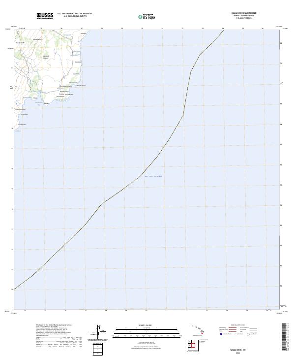
2024 Map of Kalae OE E
USGS Topo · Published 2024About this map
The southeastern coast of the Island of Hawai'i meets the Pacific Ocean in this coastal survey, where the rugged volcanic shoreline is marked by a succession of named points and coves. The terrain transitions from the upland heights of Awāwaloa and Pu'uko'ihala down to the rocky edge of the sea at Kamilo Point. This stretch of coastline is defined by its numerous small inlets and natural features, such as Ka'alu'alu Bay and Kai'ole Bay, which likely served as important landmarks and resource points for the surrounding land divisions. Local place names like Kamilopaekanaka and Kamilopa'eali'i reflect the cultural and historical geography of the region. Inland, the map traces various water features including Kaluahonu and Waipouli, illustrating the complex drainage patterns of the coastal shelf before it reaches the sea.
Find a feature on this map
30 named features on this map. Tap any name to fly to it.
Don’t see what you’re looking for? This feature index may not catch every label — zoom into the map to look around manually.
Map Details
Editions of this 2024 Kalae OE E Map
This is the sole edition of this map. No revisions or reprints were ever made.
Other maps of this area

1923 · Pahala
USGS Topo · 1:62,500

1924 · Kalae
USGS Topo · 1:62,500

1924 · Honuapo
USGS Topo · 1:62,500

1954 · Hawaii South
USGS Topo · 1:250,000

1959 · Hawaii South
USGS Topo · 1:250,000

1961 · Hawaii South
USGS Topo · 1:250,000

1962 · Hawaii South
USGS Topo · 1:250,000

1962 · Kahuku Ranch
USGS Topo · 1:24,000
1962 · Ka Lae
USGS Topo · 1:24,000
1962 · Naalehu
USGS Topo · 1:24,000