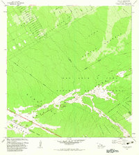
1982 Map of Kalalua
USGS Topo · Published 1983About this map
Hawaii Volcanoes National Park occupies the southwestern portion of this 1982 survey, revealing a landscape defined by active geological transformation. The East Rift Zone cuts across the center, marked by a succession of dated volcanic events including the Lava Flow of 1969, Lava Flow of 1963, and Lava Flow of 1977. These flows provide a chronological record of the island's growth, scarring the dense vegetation of the Puna Forest Reserve and the Wao Kele O Puna Natural Area Reserve.
Find a feature on this map
50 named features on this map. Tap any name to fly to it.
Don’t see what you’re looking for? This feature index may not catch every label — zoom into the map to look around manually.
Map Details
Editions of this 1982 Kalalua Map
2 editions found
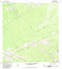
Other maps of this area

1917 · Hilo
USGS Topo · 1:62,500

1922 · Puna
USGS Topo · 1:62,500

1924 · Makuu
USGS Topo · 1:62,500

1924 · Puna
USGS Topo · 1:62,500

1924 · Kalapana
USGS Topo · 1:62,500

1932 · Hilo
USGS Topo · 1:62,500

1954 · Hawaii South
USGS Topo · 1:250,000

1954 · Hawaii North
USGS Topo · 1:250,000

1959 · Hawaii South
USGS Topo · 1:250,000

1959 · Hawaii North
USGS Topo · 1:250,000